Ocean Uses : Characterizing Mid-Atlantic Ocean Uses
Overview of Ocean Uses
The nation uses the Mid-Atlantic’s dynamic ocean environment for numerous activities including fishing, transportation, sand and gravel mining, national security activities, telecommunications, scientific research, tourism, recreation, and more. Some existing uses are expanding, and new uses—such as offshore renewable energy development and aquaculture—are emerging that require space in the Mid-Atlantic ocean.
The Mid-Atlantic Regional Council on the Ocean (MARCO) sponsored a project in 2015-2016 to characterize the broad range of human uses of the Mid-Atlantic ocean. The Human Use Data Synthesis (HUDS) project created maps that show locations of social and economic uses, highlight areas where multiple uses occur, identify patterns of data availability, and for some activities quantify the intensity of use.
The HUDS project assessed existing human use data and knowledge gaps for the region and then synthesized 64 vetted human use spatial data layers into a set of gridded map products. The HUDS project separated data into three broad categories—activities, regulatory infrastructure, and physical infrastructure—across five themes: maritime, fishing, recreation, energy and security. The maps will be publicly available on the Mid-Atlantic Ocean Data Portal.
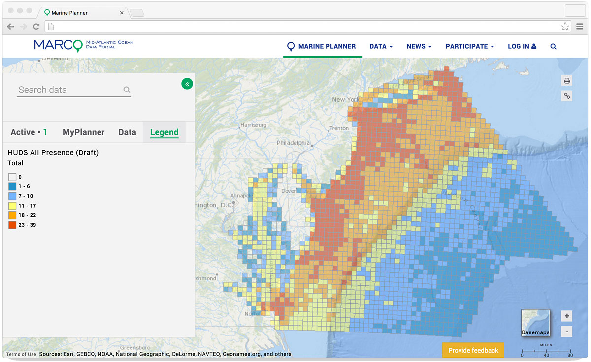
The interactive maps enable users (decision makers and the public) to view and query synthesized spatial human use information in a user-friendly framework and to see how many different human use data layers are present in each grid cell. The HUDS grids are presented as heat maps that show patterns of low to high human use data presence across the region.
Schematic of how data layers are stacked and counted within a given Human Use Data Synthesis (HUDS) grid cell. (Credit: HUDS Team)
Draft version of a comprehensive HUDS map showing the number of human use data layers (human infrastructure and activities) in each ten-kilometer grid cell. (Credit: HUDS/Mid-Atlantic Ocean Data Portal)


